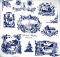
Historic New Orleans Scarf
 Historic New Orleans map
showing neighborhoods as they developed up and down
river from the French Quarter. Early 18th century French colonial
buildings of colombage (mud and moss between wood posts) and brick
between post construction of which only the Ursulines Convent remains.
The Cabildo (Hotel de Ville) and the Presbytere, financed by Andres
Almonester y Rojas, Spanish-born colonist, flank Saint Louis Cathedral,
designed by Nicolas de Pouilly, a French architect, on the site of the
first church in the French village from the late 1720s. The scarf's
anthemion border is adapted from the iron fence surrounding the Place
d'Armes. Hand-screened on hand-hemmed silk. The pacqueot (ferry) that
crossed the river is indicated.
Historic New Orleans map
showing neighborhoods as they developed up and down
river from the French Quarter. Early 18th century French colonial
buildings of colombage (mud and moss between wood posts) and brick
between post construction of which only the Ursulines Convent remains.
The Cabildo (Hotel de Ville) and the Presbytere, financed by Andres
Almonester y Rojas, Spanish-born colonist, flank Saint Louis Cathedral,
designed by Nicolas de Pouilly, a French architect, on the site of the
first church in the French village from the late 1720s. The scarf's
anthemion border is adapted from the iron fence surrounding the Place
d'Armes. Hand-screened on hand-hemmed silk. The pacqueot (ferry) that
crossed the river is indicated.The French Quarter, laid out by Adrien Pauger and LeBlonde de la Tour on the bend in the river, is flanked downriver by the Faubourg Marigny, settled by French immigrants, and sugar plantations while upriver the American city developed soon after the Louisiana Purchase of 1803. The Carondelet Canal, now covered, and the road to Bayou St. John meander behind the French Quarter, leading to Lake Pontchartrain.
Size: 35" by 35" square, hand-hemmed.
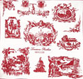
Colors: Black, Navy or Cranberry
Price: $65
To Order:
Please visit our


